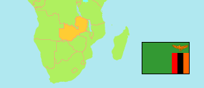
North-Western
Province in Zambia
Contents: Subdivision
The population development in North-Western as well as related information and services (Wikipedia, Google, images).
| Name | Status | Population Census 2000-10-20 | Population Census 2010-10-16 | Population Census 2022-08-18 | |
|---|---|---|---|---|---|
| North-Western | Province | 583,350 | 727,044 | 1,278,357 | |
| Chavuma | District | 29,941 | 35,041 | 55,096 | → |
| Ikelenge | District | 31,487 | 32,919 | 45,584 | → |
| Kabompo | District | 34,476 | 44,180 | 66,176 | → |
| Kalumbila (← Solwezi) | District | ... | 69,608 | 178,264 | → |
| Kasempa | District | 51,904 | 85,505 | 111,715 | → |
| Manyinga | District | 36,762 | 48,141 | 75,342 | → |
| Mufumbwe | District | 44,002 | 58,062 | 98,551 | → |
| Mushindamo (← Solwezi) | District | ... | 36,433 | 65,649 | → |
| Mwinilunga | District | 86,018 | 104,317 | 138,619 | → |
| Solwezi | District | ... | 132,532 | 334,377 | → |
| Zambezi | District | 64,963 | 80,306 | 108,984 | → |
| Zambia | Republic | 9,885,591 | 13,092,666 | 19,693,423 |
Source: Central Statistical Office Zambia.
Explanation: Provinces and districts in 2022 boundaries. The reference period of the 2022 census is 18 August to 7 September.
