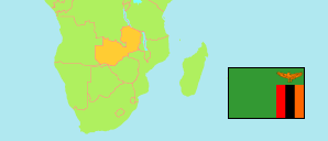
Northern
Province in Zambia
Contents: Subdivision
The population development in Northern as well as related information and services (Wikipedia, Google, images).
| Name | Status | Population Census 2000-10-20 | Population Census 2010-10-16 | Population Census 2022-08-18 | |
|---|---|---|---|---|---|
| Northern | Province | 809,400 | 1,105,824 | 1,623,853 | |
| Chilubi | District | 66,338 | 81,248 | 114,294 | → |
| Kaputa | District | 44,888 | 70,881 | 103,056 | → |
| Kasama | District | 170,929 | 231,824 | 340,678 | → |
| Lunte (← Mporokoso) | District | ... | 57,839 | 84,812 | → |
| Lupososhi (← Luwingu) | District | ... | 69,357 | 79,832 | → |
| Luwingu | District | ... | 52,779 | 101,398 | → |
| Mbala | District | ... | 110,738 | 161,935 | → |
| Mporokoso | District | ... | 41,003 | 63,695 | → |
| Mpulungu | District | 67,602 | 98,073 | 153,967 | → |
| Mungwi | District | 112,977 | 151,058 | 215,669 | → |
| Nsama | District | 42,345 | 48,633 | 77,902 | → |
| Senga Hill (← Mbala) | District | ... | 92,391 | 126,615 | → |
| Zambia | Republic | 9,885,591 | 13,092,666 | 19,693,423 |
Source: Central Statistical Office Zambia.
Explanation: Provinces and districts in 2022 boundaries. The reference period of the 2022 census is 18 August to 7 September.
