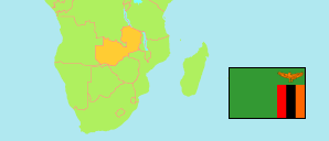
Copperbelt
Province in Zambia
Contents: Subdivision
The population development in Copperbelt as well as related information and services (Wikipedia, Google, images).
| Name | Status | Population Census 2000-10-20 | Population Census 2010-10-16 | Population Census 2022-08-18 | |
|---|---|---|---|---|---|
| Copperbelt | Province | 1,581,221 | 1,972,317 | 2,768,192 | |
| Chililabombwe | District | 67,533 | 91,833 | 142,138 | → |
| Chingola | District | 172,026 | 216,626 | 300,651 | → |
| Kalulushi | District | 75,806 | 100,381 | 170,918 | → |
| Kitwe | District | 376,124 | 517,543 | 665,961 | → |
| Luanshya | District | 147,908 | 156,059 | 212,864 | → |
| Lufwanyama | District | 63,185 | 78,503 | 133,274 | → |
| Masaiti | District | 95,581 | 103,857 | 178,405 | → |
| Mpongwe | District | 64,371 | 93,380 | 135,621 | → |
| Mufulira | District | 143,930 | 162,889 | 200,857 | → |
| Ndola | District | 374,757 | 451,246 | 627,503 | → |
| Zambia | Republic | 9,885,591 | 13,092,666 | 19,693,423 |
Source: Central Statistical Office Zambia.
Explanation: Provinces and districts in 2022 boundaries. The reference period of the 2022 census is 18 August to 7 September.