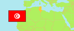
Ben Arous
Municipality in Tunis Agglomeration
Contents: Subdivision
The population development in Ben Arous as well as related information and services (Wikipedia, Google, images).
| Name | Status | Native | Population Census 2004-04-28 | Population Census 2014-04-23 | Population Census 2024-11-06 | |
|---|---|---|---|---|---|---|
| Ben Arous | Municipality | بن عروس | 74,932 | 88,322 | 89,571 | |
| Ben Arous Est | Sector | بن عروس الشرقية | 6,125 | 6,363 | 5,718 | → |
| Ben Arous Ouest | Sector | بن عروس الغربية | 9,552 | 9,494 | 8,597 | → |
| Cité El Iskane | Sector | حي الاسكان | 3,497 | 3,561 | 3,658 | → |
| Cité Ibn Arafa | Sector | حي ابن عرفة | 2,037 | 2,303 | 2,067 | → |
| El Mehiri | Sector | المهيري | 6,452 | 4,698 | 4,720 | → |
| El Yasminet | Sector | الياسمينات | 15,957 | 20,738 | 20,519 | → |
| Errabta | Sector | الرابطة | 11,054 | 16,451 | 19,202 | → |
| La Nouvelle Medina 1 | Sector | المدينة الجديدة 1 | 3,986 | 3,549 | 3,421 | → |
| La Nouvelle Medina 2 | Sector | المدينة الجديدة 2 | 3,887 | 3,908 | 4,098 | → |
| Sidi Ben Arous | Sector | سيدي بن عروس | 4,666 | 4,709 | 4,410 | → |
| Sidi Mosbah | Sector | سيدي مصباح | 7,719 | 12,548 | 13,161 | → |
| Tunis | Urban Agglomeration | تونس | 2,030,683 | 2,430,294 | 2,644,640 |
Source: Institut National de la Statistique Tunisie.
Explanation: Municipalities in 2020 boundaries. Area figures are computed using geospatial data.
Further information about the population structure:
| Gender (C 2024) | |
|---|---|
| Males | 43,983 |
| Females | 45,588 |
| Age Groups (C 2024) | |
|---|---|
| 0-14 years | 17,647 |
| 15-64 years | 60,977 |
| 65+ years | 10,947 |
| Age Distribution (C 2024) | |
|---|---|
| 80+ years | 1,805 |
| 70-79 years | 5,118 |
| 60-69 years | 9,366 |
| 50-59 years | 11,747 |
| 40-49 years | 14,271 |
| 30-39 years | 12,820 |
| 20-29 years | 10,519 |
| 10-19 years | 13,421 |
| 0-9 years | 10,504 |
