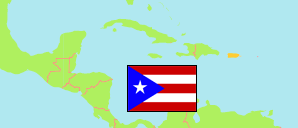
Coto Laurel (Puerto Rico)
Contents: Comunidad
The population development of Coto Laurel as well as related information and services (weather, Wikipedia, Google, images).
| Name | Municipality | Population Census 1990-04-01 | Population Census 2000-04-01 | Population Census 2010-04-01 | Population Census 2020-04-01 | |
|---|---|---|---|---|---|---|
| Coto Laurel | Ponce | 4,044 | 3,606 | 3,047 | 2,472 | → |
Source: U.S. Census Bureau (web).
Further information about the population structure:
| Gender (C 2020) | |
|---|---|
| Males | 1,197 |
| Females | 1,275 |
| Age Groups (C 2020) | |
|---|---|
| 0-17 years | 339 |
| 18-64 years | 1,361 |
| 65+ years | 772 |
| Age Distribution (C 2020) | |
|---|---|
| 80+ years | 172 |
| 70-79 years | 356 |
| 60-69 years | 436 |
| 50-59 years | 295 |
| 40-49 years | 302 |
| 30-39 years | 221 |
| 20-29 years | 264 |
| 10-19 years | 262 |
| 0-9 years | 164 |
| Urbanization (C 2020) | |
|---|---|
| Urban | 2,472 |
| »Race« (C 2020) | |
|---|---|
| Whites | 339 |
| Black/African Americans | 147 |
| Indigenous | 14 |
| Asians | 2 |
| Some other | 603 |
| 2 or more | 1,367 |
| Ethnicity (C 2020) | |
|---|---|
| Hispanic or Latino | 2,457 |
| Other | 15 |
