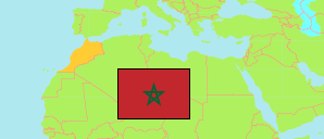
Settat
Province in Morocco
Contents: Population
The population development of Settat as well as related information and services (Wikipedia, Google, images).
| Name | Status | Native | Population Census 1994-09-02 | Population Census 2004-09-02 | Population Census 2014-09-01 | Population Census 2024-09-01 | |
|---|---|---|---|---|---|---|---|
| Settat | Province | سطات | 568,283 | 595,165 | 634,184 | 652,292 | |
| Al-Maghrib [Morocco] | Kingdom | المغرب | 25,821,571 | 29,475,763 | 33,337,529 | 36,157,337 |
Source: Haut Commissariat au Plan, Royaume du Maroc.
Explanation: Area figures are calculated using geospatial data. Some population changes are due to boundary changes.
Further information about the population structure:
| Gender (C 2014) | |
|---|---|
| Males | 319,446 |
| Females | 312,279 |
| Age Groups (C 2014) | |
|---|---|
| 0-14 years | 191,325 |
| 15-64 years | 398,909 |
| 65+ years | 41,490 |
| Age Distribution (C 2014) | |
|---|---|
| 70+ years | 29,641 |
| 60-69 years | 32,839 |
| 50-59 years | 54,910 |
| 40-49 years | 69,497 |
| 30-39 years | 91,094 |
| 20-29 years | 104,260 |
| 10-19 years | 118,548 |
| 0-9 years | 130,935 |
| Urbanization (C 2024) | |
|---|---|
| Rural | 405,203 |
| Urban | 247,089 |
| Citizenship (C 2024) | |
|---|---|
| Morocco | 651,327 |
| Foreign Citizenship | 965 |
| Literacy (A10+) (C 2014) | |
|---|---|
| yes | 421,420 |
| no | 210,305 |
