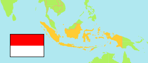
Madiun
Regency in East Java Province
Regency
The population of Madiun.
| Name | Status | Population Census 2010-05-01 | |
|---|---|---|---|
| Madiun | Regency | 662,278 | → |
| Jawa Timur [East Java] | Province | 37,476,757 |
Contents: Cities and Urban Communes
The population of the cities and urban communes in Madiun.
| Name | Status | Regency | Population Census 2010-05-01 | |
|---|---|---|---|---|
| Balerejo | Urban Commune | Madiun | 3,520 | → |
| Bangunsari | Urban Commune | Madiun | 5,002 | → |
| Bangunsari | Urban Commune | Madiun | 4,177 | → |
| Banjarsari Kulon | Urban Commune | Madiun | 5,292 | → |
| Bantengan | Urban Commune | Madiun | 3,929 | → |
| Bukur | Urban Commune | Madiun | 2,827 | → |
| Dagangan | Urban Commune | Madiun | 3,846 | → |
| Dolopo | Urban Commune | Madiun | 7,628 | → |
| Grobogan | Urban Commune | Madiun | 3,997 | → |
| Jatisari | Urban Commune | Madiun | 5,787 | → |
| Jetis | Urban Commune | Madiun | 2,379 | → |
| Jiwan | Urban Commune | Madiun | 6,621 | → |
| Kaibon | Urban Commune | Madiun | 4,448 | → |
| Kajang | Urban Commune | Madiun | 1,361 | → |
| Kanung | Urban Commune | Madiun | 1,515 | → |
| Kebonsari | Urban Commune | Madiun | 4,977 | → |
| Kedondong | Urban Commune | Madiun | 4,117 | → |
| Kertobanyon | Urban Commune | Madiun | 1,570 | → |
| Ketawang | Urban Commune | Madiun | 3,029 | → |
| Kincang Wetan | Urban Commune | Madiun | 7,696 | → |
| Krajan | Urban Commune | Madiun | 4,262 | → |
| Kwangsen | Urban Commune | Madiun | 2,956 | → |
| Mejayan | Urban Commune | Madiun | 4,574 | → |
| Mlilir | Urban Commune | Madiun | 5,142 | → |
| Mojopurno | Urban Commune | Madiun | 5,621 | → |
| Mojorejo | Urban Commune | Madiun | 2,383 | → |
| Munggut | Urban Commune | Madiun | 6,715 | → |
| Ngampel | Urban Commune | Madiun | 3,249 | → |
| Nglames | Urban Commune | Madiun | 3,512 | → |
| Pagotan | Urban Commune | Madiun | 2,704 | → |
| Pandeyan | Urban Commune | Madiun | 1,935 | → |
| Plumpungrejo | Urban Commune | Madiun | 3,823 | → |
| Prambon | Urban Commune | Madiun | 1,630 | → |
| Purworejo | Urban Commune | Madiun | 5,356 | → |
| Purwosari | Urban Commune | Madiun | 4,470 | → |
| Sambirejo | Urban Commune | Madiun | 4,432 | → |
| Sangen | Urban Commune | Madiun | 3,421 | → |
| Sewulan | Urban Commune | Madiun | 3,689 | → |
| Sidomulyo | Urban Commune | Madiun | 2,804 | → |
| Sidorejo | Urban Commune | Madiun | 5,182 | → |
| Slambur | Urban Commune | Madiun | 1,772 | → |
| Sukolilo | Urban Commune | Madiun | 4,813 | → |
| Sumbergandu | Urban Commune | Madiun | 2,912 | → |
| Teguhan | Urban Commune | Madiun | 4,152 | → |
| Tempursari | Urban Commune | Madiun | 4,261 | → |
| Tiron | Urban Commune | Madiun | 5,002 | → |
| Uteran | Urban Commune | Madiun | 4,002 | → |
| Wayut | Urban Commune | Madiun | 4,975 | → |
Source: Badan Pusat Statistik, Republik Indonesia (web).
Explanation: Urban communes and the urban parts of cities as defined in 2010; area figures are computed by using geospatial data. Regencies and administrative cities in the boundaries of 2015.