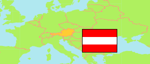
Sankt Lambrecht
in Murau (Steiermark)
Contents: Commune
The population development of Sankt Lambrecht as well as related information and services (weather, Wikipedia, Google, images).
| Name | District | Population Census 1981-05-12 | Population Census 1991-05-15 | Population Census 2001-05-15 | Population Census 2011-10-31 | Population Census 2021-10-31 | Population Estimate 2025-01-01 | ||||||||||||
|---|---|---|---|---|---|---|---|---|---|---|---|---|---|---|---|---|---|---|---|
| Sankt Lambrecht | Murau | 2,692 | 2,505 | 2,374 | 2,019 | 1,752 | 1,784 | → | |||||||||||
Sankt Lambrecht 1,784 Population [2025] – Estimate 70.18 km² Area 25.42/km² Population Density [2025] 0.57% Annual Population Change [2021 → 2025] | |||||||||||||||||||
Source: Statistik Austria.
Explanation: 2025 population figures are final estimates.
Further information about the population structure:
| Gender (E 2025) | |
|---|---|
| Males | 862 |
| Females | 922 |
| Age Groups (E 2025) | |
|---|---|
| 0-17 years | 263 |
| 18-64 years | 989 |
| 65+ years | 532 |
| Age Distribution (E 2025) | |
|---|---|
| 90+ years | 29 |
| 80-89 years | 115 |
| 70-79 years | 203 |
| 60-69 years | 339 |
| 50-59 years | 262 |
| 40-49 years | 228 |
| 30-39 years | 194 |
| 20-29 years | 127 |
| 10-19 years | 146 |
| 0-9 years | 141 |
| Citizenship (E 2025) | |
|---|---|
| Austria | 1,573 |
| EU, EFTA, UK | 132 |
| Other Citizenship | 79 |
| Country of Birth (E 2025) | |
|---|---|
| Austria | 1,546 |
| EU, EFTA, UK | 108 |
| Other country | 130 |
