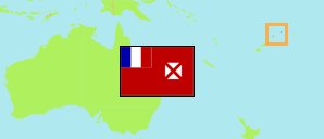
Wallis and Futuna consititute a French overseas collectivity.
Islands & Districts
The population of the islands and districts of Wallis and Futuna by census years.
| Name | Abbr. | Status | Area A (km²) | Population Census (C) 1990-10-09 | Population Census (C) 1996-10-03 | Population Census (C) 2003-07-22 | Population Census (C) 2008-07-21 | Population Census (C) 2013-07-22 | Population Census (C) 2018-07-23 | Population Census (C) 2023-07-24 | |||
|---|---|---|---|---|---|---|---|---|---|---|---|---|---|
| Wallis and Futuna | WLF | Terr | 142 | 13,705 | 14,166 | 14,944 | 13,445 | 12,197 | 11,558 | 11,151 | → | ||
| Alo | ALO | Dist | 47 | 2,860 | 2,890 | 2,993 | 2,655 | 2,156 | 1,950 | 1,875 | 4700 | → | |
| Sigave | SIG | Dist | 17 | 1,872 | 1,746 | 1,880 | 1,583 | 1,457 | 1,275 | 1,188 | 1700 | → | |
| Futuna | FUT | Isl | 64 | 4,732 | 4,638 | 4,873 | 4,238 | 3,613 | 3,225 | 3,063 | 6400 | ||
| Hahake | HAH | Dist | 28 | 3,256 | 3,647 | 3,950 | 3,748 | 3,529 | 3,415 | 3,343 | 2800 | → | |
| Hihifo | HIH | Dist | 24 | 2,105 | 2,328 | 2,422 | 2,197 | 2,009 | 1,942 | 1,855 | 2400 | → | |
| Mua | MUA | Dist | 26 | 3,612 | 3,553 | 3,699 | 3,262 | 3,046 | 2,976 | 2,890 | 2600 | → | |
| Wallis (Uvea) | WAL | Isl | 78 | 8,973 | 9,528 | 10,071 | 9,207 | 8,584 | 8,333 | 8,088 | 7800 |
- Institut National de la Statistique et des Études Économiques France / Wallis & Futuna.
Contents: Villages
The population of all villages on the Wallis and Futuna Islands with more than 500 inhabitants by census years.
| Name | Adm. | Population Census (C) 1990-10-09 | Population Census (C) 1996-10-03 | Population Census (C) 2003-07-22 | Population Census (C) 2008-07-21 | Population Census (C) 2013-07-22 | Population Census (C) 2018-07-23 | Population Census (C) 2023-07-24 | Area | ||
|---|---|---|---|---|---|---|---|---|---|---|---|
| Aka'aka | HAH | 315 | 379 | 538 | 509 | 495 | 474 | 435 | 83 | → | |
| Alele | HIH | 597 | 610 | 634 | 631 | 551 | 524 | 488 | 299 | → | |
| Falaleu | HAH | 639 | 608 | 650 | 627 | 586 | 572 | 550 | 267 | → | |
| Halalo | MUA | 634 | 648 | 637 | 563 | 478 | 471 | 460 | 180 | → | |
| Liku | HAH | 601 | 669 | 688 | 663 | 589 | 605 | 613 | 305 | → | |
| Mala'e | HIH | 227 | 386 | 498 | 497 | 463 | 504 | 483 | 664 | → | |
| Mata'utu [Mata-Utu] | HAH | 1,222 | 1,137 | 1,191 | 1,126 | 1,075 | 1,029 | 984 | 434 | → | |
| Ono | ALO | 627 | 709 | 738 | 666 | 537 | 524 | 504 | 235 | → | |
| Taoa | ALO | 598 | 724 | 717 | 623 | 531 | 480 | 443 | 820 | → | |
| Utufua | MUA | 673 | 674 | 736 | 622 | 615 | 602 | 588 | 177 | → | |
| Vaitupu | HIH | 625 | 634 | 607 | 499 | 441 | 406 | 378 | 149 | → |
- Institut National de la Statistique et des Études Économiques France/ Wallis & Futuna.
