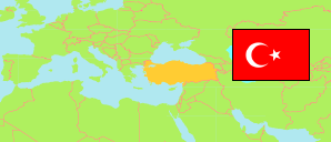
Turkey: Karaman
Districts
The population of the districts in the Province of Karaman.
| Name | Status | Population Estimate 2009-12-31 | Population Estimate 2013-12-31 | Population Estimate 2017-12-31 | Population Estimate 2022-12-31 | |
|---|---|---|---|---|---|---|
| Ayrancı | District | 9,869 | 8,934 | 8,157 | 7,608 | → |
| Başyayla | District | 4,858 | 4,102 | 3,651 | 3,432 | → |
| Ermenek | District | 30,897 | 30,064 | 28,903 | 27,776 | → |
| Kazımkarabekir | District | 4,608 | 4,278 | 4,344 | 4,531 | → |
| Merkez | District | 168,048 | 177,685 | 190,366 | 206,240 | → |
| Sarıveliler | District | 13,592 | 12,876 | 11,251 | 11,251 | → |
| Karaman | Province | 231,872 | 237,939 | 246,672 | 260,838 |
Contents: Cities, Towns and Villages
All cities, towns and villages in the Province of Karaman with 750 inhabitants or more.
| Name | Status | District | Population Estimate 2009-12-31 | Population Estimate 2013-12-31 | Population Estimate 2017-12-31 | Population Estimate 2022-12-31 | |
|---|---|---|---|---|---|---|---|
| Akçaşehir | Town | Merkez | 2,528 | 2,354 | 2,209 | 2,172 | → |
| Ardıçkaya | Village | Ermenek | 1,338 | 1,277 | 1,075 | 955 | → |
| Aşağıçağlar | Village | Ermenek | 1,071 | 1,056 | 979 | 922 | → |
| Ayrancı | City | Ayrancı | 2,490 | 2,436 | 2,317 | 2,292 | → |
| Başyayla | City | Başyayla | 2,663 | 2,081 | 1,956 | 1,895 | → |
| Çakırbağ | Village | Merkez | 1,359 | 1,531 | 1,589 | 1,540 | → |
| Civler | Village | Sarıveliler | 1,502 | 1,430 | 1,313 | 1,249 | → |
| Dere | Village | Merkez | 962 | 1,099 | 1,167 | 1,173 | → |
| Dumlugöze | Village | Sarıveliler | 1,750 | 1,619 | 1,513 | 1,449 | → |
| Ermenek | City | Ermenek | 10,827 | 11,070 | 11,550 | 11,629 | → |
| Gökçekent | Village | Ermenek | 1,197 | 1,081 | 949 | 839 | → |
| Göktepe | Town | Sarıveliler | 2,071 | 2,570 | 2,124 | 2,051 | → |
| Güneyyurt | Town | Ermenek | 5,181 | 5,229 | 5,132 | 4,982 | → |
| Karaman | City | Merkez | 132,064 | 144,172 | 158,561 | 175,390 | → |
| Kazancı | Town | Ermenek | 2,682 | 2,548 | 2,196 | 2,151 | → |
| Kazımkarabekir | City | Kazımkarabekir | 3,312 | 3,055 | 3,266 | 3,456 | → |
| Kılbasan | Village | Merkez | 1,709 | 1,611 | 1,664 | 1,571 | → |
| Sarıveliler (incl. Adiller) | City | Sarıveliler | 5,478 | 5,866 | ... | 5,274 | → |
| Sudurağı | Town | Merkez | 2,283 | 2,336 | 2,304 | 2,314 | → |
| Süleymanhacı | Village | Merkez | 787 | 774 | 789 | 772 | → |
| Yeşildere | Village | Merkez | ... | 899 | 818 | 798 | → |
| Yollarbaşı | Village | Merkez | 1,203 | 1,151 | 1,054 | 971 | → |
Source: State Institute of Statistics, Republic of Türkiye.
Explanation: Since 2013, the population figures of cities in metropolitan provinces are calculated by using the population of selected neighborhoods.
