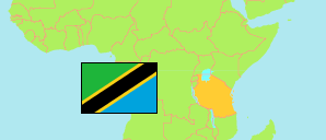
Mvomero
District in Coastal Tanzania
Contents: Subdivision
The population in Mvomero as well as related information and services (Wikipedia, Google, images).
| Name | Status | Population Census 2022-08-23 | |
|---|---|---|---|
| Mvomero | District | 421,741 | |
| Bunduki | Rural Ward | 6,464 | → |
| Dakawa | Mixed Ward | 34,810 | → |
| Diongoya | Rural Ward | 31,421 | → |
| Doma | Rural Ward | 14,358 | → |
| Hembeti | Rural Ward | 11,332 | → |
| Homboza | Rural Ward | 8,355 | → |
| Kanga | Rural Ward | 15,757 | → |
| Kibati | Rural Ward | 18,379 | → |
| Kikeo | Rural Ward | 8,226 | → |
| Kinda | Rural Ward | 8,313 | → |
| Kweuma | Rural Ward | 5,911 | → |
| Langali | Mixed Ward | 4,522 | → |
| Luale | Rural Ward | 7,316 | → |
| Lubungo | Rural Ward | 8,488 | → |
| Mangae | Rural Ward | 8,795 | → |
| Maskati | Rural Ward | 9,982 | → |
| Melela | Rural Ward | 8,920 | → |
| Mgeta | Rural Ward | 3,789 | → |
| Mhonda | Mixed Ward | 19,278 | → |
| Mkindo | Rural Ward | 15,523 | → |
| Mlali | Mixed Ward | 23,384 | → |
| Msongozi | Rural Ward | 5,155 | → |
| Mtibwa | Mixed Ward | 38,287 | → |
| Mvomero | Mixed Ward | 25,654 | → |
| Mziha | Rural Ward | 14,590 | → |
| Mzumbe | Mixed Ward | 19,677 | → |
| Nyandira | Rural Ward | 7,801 | → |
| Pemba | Rural Ward | 14,840 | → |
| Sungaji | Rural Ward | 18,450 | → |
| Tchenzema | Rural Ward | 3,964 | → |
| Coastal | Zone | 13,434,754 |
Source: National Bureau of Statistics Tanzania.
Explanation: Area figures are derived from geospatial data.