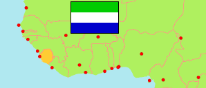
Karene
District in Sierra Leone
Contents: Subdivision
The population development in Karene as well as related information and services (Wikipedia, Google, images).
| Name | Status | Population Census 2004-12-04 | Population Census 2015-12-04 | Population Census 2021-12-09 | |
|---|---|---|---|---|---|
| Karene | District | 210,884 | 285,546 | 290,313 | |
| Buya | Chiefdom | ... | 13,174 | 14,378 | → |
| Dibia | Chiefdom | 15,077 | 15,519 | 24,059 | → |
| Gbanti | Chiefdom | ... | 16,639 | 19,789 | → |
| Libeisaygahun/Gbombahun | Chiefdom | ... | 11,770 | 13,510 | → |
| Mafonda Makerembay | Chiefdom | ... | 4,429 | 6,560 | → |
| Romende | Chiefdom | ... | 21,107 | 27,860 | → |
| Safroko | Chiefdom | ... | 10,980 | 9,158 | → |
| Sanda Loko | Chiefdom | 27,667 | 45,075 | 24,862 | → |
| Sanda Magbolontor | Chiefdom | 15,088 | 23,731 | 27,862 | → |
| Sanda Tendaran | Chiefdom | 18,840 | 26,228 | 29,782 | → |
| Sella Limba | Chiefdom | 52,579 | 58,401 | 58,066 | → |
| Tambakha Simibungie | Chiefdom | ... | 14,030 | 9,805 | → |
| Tambakha Yobangie | Chiefdom | ... | 24,463 | 24,622 | → |
| Sierra Leone | Republic | 4,976,871 | 7,092,113 | 7,548,702 |
Source: Statistics Sierra Leone (web).
Explanation: Boundaries of districts and chiefdoms according to the administrative reorganization of 2017. The 2021 census is a mid-term census. The reasons for the significant differences between the 2015 and 2021 figures are unclear. Area figures are derived from geospatial data.