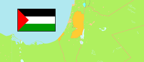
Umm Ashoqhan
in Al-Khalil (West Bank)
Contents: Rural Locality
The population development of Umm Ashoqhan as well as related information and services (weather, Wikipedia, Google, images).
| Name | Native | Governorate | Population Census 1997-12-10 | Population Census 2007-12-01 | Population Census 2017-12-01 | ||||||||||||||
|---|---|---|---|---|---|---|---|---|---|---|---|---|---|---|---|---|---|---|---|
| Umm Ashoqhan | أم الشقحان | Al-Khalil | ... | 296 | 605 | → | |||||||||||||
Umm Ashoqhan 605 Population [2017] – Census 0.8750 km² Area 691.4/km² Population Density [2017] 7.4% Annual Population Change [2007 → 2017] | |||||||||||||||||||
Source: Palestinian Central Bureau of Statistics.
Explanation: The presented population figures include Arabs in those parts of East Jerusalem which are annexed by Israel. They do not include the Israelian settlers in the West Bank. Area figures and the map presentation include also areas that are not administered by the Palestinian National Authority.
Further information about the population structure:
| Gender (C 2017) | |
|---|---|
| Males | 312 |
| Females | 290 |
| Age Groups (C 2017) | |
|---|---|
| 0-14 years | 297 |
| 15-64 years | 295 |
| 65+ years | 10 |
| Age Distribution (C 2017) | |
|---|---|
| 60+ years | 13 |
| 50-59 years | 16 |
| 40-49 years | 50 |
| 30-39 years | 56 |
| 20-29 years | 117 |
| 10-19 years | 131 |
| 0-9 years | 219 |
