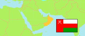
Ẓufār
Governorate in Oman
Contents: Subdivision
The population development in Ẓufār as well as related information and services (Wikipedia, Google, images).
| Name | Status | Native | Population Census 2003-12-07 | Population Census 2010-12-12 | Population Census 2020-12-12 | |
|---|---|---|---|---|---|---|
| Ẓufār [Dhofar] | Governorate | ظفار | 215,960 | 249,729 | 416,458 | |
| Al-Mazyūnah [← Muqshin] | District | المزيونة | ... | 8,039 | 8,399 | → |
| Ḍalkūt [Dhalkut] | District | ضلكوت | 2,952 | 2,809 | 3,179 | → |
| Mirbāṭ | District | مرباط | 14,987 | 13,919 | 16,364 | → |
| Muqshin | District | مقشن | 529 | 1,069 | 627 | → |
| Rakhyūt | District | رخيوت | 4,488 | 4,501 | 4,985 | → |
| Sadaḥ | District | سدح | 5,463 | 6,384 | 6,016 | → |
| Ṣalālah | District | صلالة | 156,530 | 172,570 | 331,949 | → |
| Shalīm & Juzur al-Ḥallāniyyāt [Shalim and the Hallaniyat Islands] | District | شليم وجزر الحلانيات | 5,123 | 8,697 | 6,339 | → |
| Ṭāqah | District | طاقة | 17,458 | 18,218 | 21,487 | → |
| Ṭumrayt [Thumrait] | District | ثمريت | 8,430 | 13,523 | 17,113 | → |
| ʻUmān [Oman] | Sultanate | عمان | 2,340,815 | 2,773,479 | 4,617,927 |
Source: Sultanate of Oman, National Centre for Statistics and Information (web).
Explanation: The 2020 census was organized as an electronic census.
Further information about the population structure:
| Gender (C 2020) | |
|---|---|
| Males | 271,358 |
| Females | 145,100 |
| Age Groups (C 2020) | |
|---|---|
| 0-14 years | 96,259 |
| 15-64 years | 310,644 |
| 65+ years | 9,555 |
| Age Distribution (C 2020) | |
|---|---|
| 0-9 years | 70,136 |
| 10-19 years | 47,366 |
| 20-29 years | 75,783 |
| 30-39 years | 116,862 |
| 40-49 years | 61,599 |
| 50-59 years | 27,059 |
| 60-69 years | 11,972 |
| 70-79 years | 4,007 |
| 80+ years | 1,674 |
| Citizenship (C 2020) | |
|---|---|
| Omani | 215,091 |
| Foreign Citizenship | 201,367 |