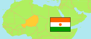
Gaya
Department in Dosso Region
Department
The population development of Gaya.
| Name | Status | Population Census 2001-05-20 | Population Census 2012-12-10 | |
|---|---|---|---|---|
| Gaya | Department | 176,235 | 261,638 | → |
| Dosso | Region | 1,505,864 | 2,037,713 |
Contents: Localities
The population development of the localities in Gaya.
| Name | Status | Department | Population Census 2001-05-20 | Population Census 2012-12-10 | |
|---|---|---|---|---|---|
| Adiga Léle | Village | Gaya | 1,288 | 1,582 | → |
| Angoual Sani | Village | Gaya | 679 | 1,081 | → |
| Bana | Village | Gaya | 2,486 | 3,922 | → |
| Bana Guinde | Hamlet | Gaya | 546 | 1,190 | → |
| Banikoubeye I | Village | Gaya | ... | 1,177 | → |
| Bengou | Locality | Gaya | 9,279 | 12,329 | → |
| Dolé | Village | Gaya | 3,186 | 3,325 | → |
| Faska | Locality | Gaya | 1,093 | 1,534 | → |
| Fatchora | Village | Gaya | ... | 1,660 | → |
| Garin Gueffo | Hamlet | Gaya | ... | 1,112 | → |
| Gatawani Béri | Village | Gaya | 1,577 | 2,159 | → |
| Gattawani Kaïna | Village | Gaya | 1,494 | 2,871 | → |
| Gaya | Urban Locality | Gaya | 28,385 | 45,465 | → |
| Gondarou | Village | Gaya | 1,030 | 1,696 | → |
| Hankoura | Village | Gaya | 1,124 | 1,609 | → |
| Kada Koira Zéno | Hamlet | Gaya | 747 | 1,003 | → |
| Kahel | Village | Gaya | 696 | 1,036 | → |
| Kawara N'Debe | Village | Gaya | 2,144 | 3,132 | → |
| Kawara N'Gohe | Village | Gaya | 1,110 | 1,266 | → |
| Lesso Matche | Village | Gaya | 841 | 1,058 | → |
| Malgorou | Village | Gaya | 3,544 | 5,115 | → |
| Mombeye Tounga | Village | Gaya | 1,156 | 1,794 | → |
| Niakoye Tonga | Village | Gaya | 1,763 | 3,081 | → |
| Sabon Birni | Village | Gaya | 5,584 | 5,970 | → |
| Sabon Gari Foga | Hamlet | Gaya | 657 | 1,122 | → |
| Sia | Village | Gaya | 2,601 | 3,554 | → |
| Tanagaye | Village | Gaya | 866 | 1,092 | → |
| Tanda | Village | Gaya | 5,761 | 8,098 | → |
| Tara | Locality | Gaya | 3,950 | 4,989 | → |
| Tounga Tégui | Village | Gaya | 1,013 | 1,324 | → |
| Tounouga | Village | Gaya | 4,550 | 8,296 | → |
| Tounouga / Sabon Birni | Village | Gaya | ... | 2,589 | → |
| Yélou | Village | Gaya | 2,209 | 3,407 | → |
Source: Institut National de la Statistique du Niger (web).