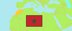
Tata
Province in Souss - Massa
Province
The population development of Tata.
| Name | Native | Status | Population Census 1994-09-02 | Population Census 2004-09-02 | Population Census 2014-09-01 | Population Census 2024-09-01 | |
|---|---|---|---|---|---|---|---|
| Tata | طاطا | Province | 119,298 | 121,618 | 117,841 | 111,757 | → |
| Souss - Massa | سوس - ماسة | Region | 1,926,288 | 2,324,142 | 2,676,847 | 3,020,431 |
Contents: Urban Communes and Urban Centers
The population development of the urban communes and urban centers in Tata.
| Name | Native | Status | Province / Prefecture | Population Census 1994-09-02 | Population Census 2004-09-02 | Population Census 2014-09-01 | Population Census 2024-09-01 | |
|---|---|---|---|---|---|---|---|---|
| Akka | اقا | Urban Commune | Tata | 6,519 | 7,102 | 6,870 | 5,575 | → |
| Fam El Hisn | فم الحصن | Urban Commune | Tata | 7,040 | 7,089 | 6,353 | 5,908 | → |
| Foum Zguid | فم زكيد | Urban Commune | Tata | 9,903 | 9,630 | 8,986 | 8,660 | → |
| Tata | طاطا | Urban Commune | Tata | 12,549 | 15,239 | 18,611 | 19,544 | → |
Source: Haut Commissariat au Plan, Royaume du Maroc.
