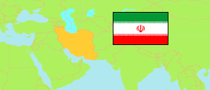
Chahārmahāl va Bakhtīārī
Province in Iran
Contents: Subdivision
The population development in Chahārmahāl va Bakhtīārī as well as related information and services (Wikipedia, Google, images).
| Name | Status | Native | Population Census 2011-10-24 | Population Census 2016-09-24 | |
|---|---|---|---|---|---|
| Chahārmahāl va Bakhtīārī [Chaharmahal and Bakhtiari] | Province | چهارمحال و بختیاری | 895,263 | 947,763 | |
| Ardal | County | شهرستان اردل | 53,514 | 48,880 | → |
| Ben [← Shahr-e Kord] | County | شهرستان بن | 29,481 | 28,326 | → |
| Borūjen | County | شهرستان بروجن | 118,681 | 122,483 | → |
| Fārsān | County | شهرستان فارسان | 93,941 | 95,286 | → |
| Kīār | County | شهرستان کیار | 58,047 | 50,976 | → |
| Kūhrang | County | شهرستان کوهرنگ | 35,915 | 41,535 | → |
| Lordegān | County | شهرستان لردگان | 194,783 | 209,681 | → |
| Sāmān [← Shahr-e Kord] | County | شهرستان سامان | 35,895 | 34,616 | → |
| Shahr-e Kord | County | شهرستان شهرکرد | 275,006 | 315,980 | → |
| Iran | Islamic Republic | ایران | 75,149,669 | 79,926,270 |
Source: Statistical Centre of Iran (web).
Explanation: Area figures of counties are derived from geospatial data.
Further information about the population structure:
| Gender (C 2016) | |
|---|---|
| Males | 482,356 |
| Females | 465,407 |
| Age Groups (C 2016) | |
|---|---|
| 0-14 years | 246,482 |
| 15-64 years | 646,501 |
| 65+ years | 54,780 |
| Age Distribution (C 2016) | |
|---|---|
| 90+ years | 1,468 |
| 80-89 years | 11,767 |
| 70-79 years | 21,889 |
| 60-69 years | 47,250 |
| 50-59 years | 77,532 |
| 40-49 years | 116,984 |
| 30-39 years | 177,470 |
| 20-29 years | 180,210 |
| 10-19 years | 138,292 |
| 0-9 years | 174,901 |
| Urbanization (C 2016) | |
|---|---|
| Rural | 339,667 |
| Urban | 607,444 |
| Literacy (A6+) (C 2016) | |
|---|---|
| yes | 709,075 |
| no | 127,842 |