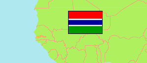
Kerewan
Local Government Area in Gambia
Contents: Subdivision
The population development in Kerewan as well as related information and services (Wikipedia, Google, images).
| Name | Status | Population Census 1993-04-15 | Population Census 2003-04-15 | Population Census 2013-04-15 | |
|---|---|---|---|---|---|
| Kerewan (North Bank) | Local Government Area | 156,462 | 172,835 | 220,080 | |
| Central Badibu | District | 15,060 | 14,998 | 19,491 | → |
| Illiasa (← Upper Badibu) | District | ... | ... | 48,620 | → |
| Jokadu | District | 14,874 | 17,850 | 22,312 | → |
| Lower Badibu | District | 14,391 | 15,157 | 17,961 | → |
| Lower Niumi | District | 35,147 | 44,491 | 57,088 | → |
| Sabach Sanjal (← Upper Badibu) | District | ... | ... | 23,728 | → |
| Upper Niumi | District | 21,552 | 24,940 | 30,880 | → |
| Gambia | Republic | 1,038,145 | 1,360,681 | 1,857,181 |
Source: The Gambia Bureau of Statistics (web).
Explanation: Area figures of districts are computed by using geospatial data.
Further information about the population structure:
| Gender (C 2013) | |
|---|---|
| Males | 105,912 |
| Females | 114,168 |
| Age Groups (C 2013) | |
|---|---|
| 0-14 years | 103,381 |
| 15-49 years | 95,380 |
| 50+ years | 21,309 |