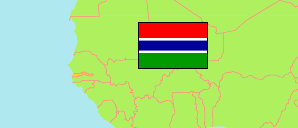
Brikama
Local Government Area in Gambia
Contents: Subdivision
The population development in Brikama as well as related information and services (Wikipedia, Google, images).
| Name | Status | Population Census 1993-04-15 | Population Census 2003-04-15 | Population Census 2013-04-15 | |
|---|---|---|---|---|---|
| Brikama (Western) | Local Government Area | 234,917 | 389,594 | 688,744 | |
| Foni Bintang-Karanai | District | 11,397 | 15,994 | 17,119 | → |
| Foni Bondali | District | 4,594 | 6,049 | 7,578 | → |
| Foni Brefet | District | 8,529 | 11,411 | 14,523 | → |
| Foni Jarrol | District | 5,355 | 5,943 | 6,883 | → |
| Foni Kansala | District | 7,748 | 12,247 | 14,125 | → |
| Kombo Central | District | 56,094 | 84,315 | 140,029 | → |
| Kombo East | District | 21,028 | 28,146 | 42,330 | → |
| Kombo North (/Saint Mary) | District | 80,478 | 166,351 | 339,377 | → |
| Kombo South | District | 39,694 | 62,531 | 106,780 | → |
| Gambia | Republic | 1,038,145 | 1,360,681 | 1,857,181 |
Source: The Gambia Bureau of Statistics (web).
Explanation: Area figures of districts are computed by using geospatial data.
Further information about the population structure:
| Gender (C 2013) | |
|---|---|
| Males | 344,621 |
| Females | 344,123 |
| Age Groups (C 2013) | |
|---|---|
| 0-14 years | 288,837 |
| 15-49 years | 344,386 |
| 50+ years | 55,166 |