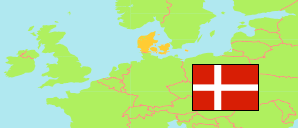
Slagelse
Municipality in Sjælland
Municipality
The population development of Slagelse.
| Name | Status | Population Estimate 2006-01-01 | Population Estimate 2011-01-01 | Population Estimate 2016-01-01 | Population Estimate 2021-01-01 | Population Estimate 2025-01-01 | |
|---|---|---|---|---|---|---|---|
| Slagelse | Municipality | 76,519 | 77,442 | 78,140 | 79,122 | 80,481 | → |
| Sjælland [Zealand] | Region | 811,511 | 819,763 | 827,499 | 838,840 | 854,902 |
Contents: Urban Settlements
The population development of the urban settlements in Slagelse.
| Name | Status | Municipality | Population Estimate 2006-01-01 | Population Estimate 2011-01-01 | Population Estimate 2016-01-01 | Population Estimate 2021-01-01 | Population Estimate 2025-01-01 | |
|---|---|---|---|---|---|---|---|---|
| Bisserup | Urban Settlement | Slagelse | 557 | 551 | 520 | 524 | 499 | → |
| Boeslunde | Urban Settlement | Slagelse | 767 | 784 | 787 | 759 | 759 | → |
| Dalmose | Urban Settlement | Slagelse | 946 | 1,007 | 1,002 | 959 | 963 | → |
| Flakkebjerg | Urban Settlement | Slagelse | 387 | 453 | 444 | 448 | 442 | → |
| Forlev | Urban Settlement | Slagelse | 2,164 | 2,541 | 2,498 | 2,542 | 2,551 | → |
| Frølunde Fed | Cottage Settlement | Slagelse | ... | ... | 205 | 266 | 301 | → |
| Havrebjerg | Urban Settlement | Slagelse | 391 | 429 | 407 | 397 | 386 | → |
| Kirke Stillinge | Urban Settlement | Slagelse | 505 | 713 | 701 | 672 | 738 | → |
| Kongsmark Strand | Cottage Settlement | Slagelse | ... | 205 | 225 | 250 | 232 | → |
| Korsør | Urban Settlement | Slagelse | 14,850 | 14,412 | 14,603 | 14,516 | 14,323 | → |
| Næsby Strand | Cottage Settlement | Slagelse | ... | ... | ... | 205 | 218 | → |
| Rude | Urban Settlement | Slagelse | 278 | 295 | 271 | 276 | 288 | → |
| Skælskør | Urban Settlement | Slagelse | 6,373 | 6,358 | 6,510 | 6,440 | 6,304 | → |
| Slagelse | Urban Settlement | Slagelse | 31,778 | 31,979 | 33,000 | 34,118 | 35,817 | → |
| Slots Bjergby | Urban Settlement | Slagelse | 555 | 723 | 792 | 864 | 1,019 | → |
| Sørbymagle | Urban Settlement | Slagelse | 1,029 | 1,174 | 1,113 | 1,099 | 1,111 | → |
| Stillinge Strand | Cottage Settlement | Slagelse | ... | 211 | 325 | 363 | 367 | → |
| Svenstrup | Urban Settlement | Slagelse | 1,949 | 2,002 | 1,930 | 1,906 | 1,844 | → |
Source: Denmark Statistik.
