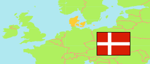
Ikast-Brande
Municipality in Midtjylland
Municipality
The population development of Ikast-Brande.
| Name | Status | Population Estimate 2006-01-01 | Population Estimate 2011-01-01 | Population Estimate 2016-01-01 | Population Estimate 2021-01-01 | Population Estimate 2025-01-01 | |
|---|---|---|---|---|---|---|---|
| Ikast-Brande | Municipality | 39,528 | 40,571 | 40,798 | 41,473 | 43,009 | → |
| Midtjylland [Mid Jutland] | Region | 1,219,725 | 1,260,993 | 1,293,309 | 1,332,048 | 1,373,799 |
Contents: Urban Settlements
The population development of the urban settlements in Ikast-Brande.
| Name | Status | Municipality | Population Estimate 2006-01-01 | Population Estimate 2011-01-01 | Population Estimate 2016-01-01 | Population Estimate 2021-01-01 | Population Estimate 2025-01-01 | |
|---|---|---|---|---|---|---|---|---|
| Blåhøj | Urban Settlement | Ikast-Brande | 323 | 369 | 372 | 353 | 367 | → |
| Bording | Urban Settlement | Ikast-Brande | 2,255 | 2,318 | 2,352 | 2,374 | 2,439 | → |
| Brande | Urban Settlement | Ikast-Brande | 6,388 | 6,959 | 7,138 | 7,394 | 7,394 | → |
| Ejstrupholm | Urban Settlement | Ikast-Brande | 1,658 | 1,677 | 1,698 | 1,698 | 1,710 | → |
| Engesvang | Urban Settlement | Ikast-Brande | 1,901 | 2,010 | 2,029 | 2,024 | 2,190 | → |
| Gludsted | Urban Settlement | Ikast-Brande | 264 | 307 | 306 | 308 | 319 | → |
| Hampen | Urban Settlement | Ikast-Brande | 342 | 362 | 334 | 345 | 333 | → |
| Ikast | Urban Settlement | Ikast-Brande | 14,778 | 15,024 | 15,318 | 15,783 | 16,808 | → |
| Isenvad | Urban Settlement | Ikast-Brande | 555 | 610 | 645 | 702 | 702 | → |
| Klovborg | Urban Settlement | Ikast-Brande | 537 | 540 | 561 | 546 | 516 | → |
| Nørre Snede | Urban Settlement | Ikast-Brande | 1,876 | 1,866 | 1,875 | 1,849 | 1,912 | → |
| Pårup | Urban Settlement | Ikast-Brande | 247 | 223 | 249 | 227 | 239 | → |
| Tulstrup | Urban Settlement | Ikast-Brande | 576 | 613 | 621 | 622 | 617 | → |
| Uhre | Urban Settlement | Ikast-Brande | 238 | 282 | 269 | 278 | 260 | → |
Source: Denmark Statistik.
