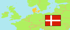
Egedal
Municipality in Hovedstaden
Municipality
The population development of Egedal.
| Name | Status | Population Estimate 2006-01-01 | Population Estimate 2011-01-01 | Population Estimate 2016-01-01 | Population Estimate 2021-01-01 | Population Estimate 2025-01-01 | |
|---|---|---|---|---|---|---|---|
| Egedal | Municipality | 39,948 | 41,614 | 42,773 | 43,696 | 45,563 | → |
| Hovedstaden [Capital Region] | Region | 1,633,565 | 1,699,387 | 1,789,174 | 1,855,084 | 1,930,793 |
Contents: Urban Areas and Settlements
The population development of the urban areas and settlements in Egedal.
| Name | Status | Municipality | Population Estimate 2006-01-01 | Population Estimate 2011-01-01 | Population Estimate 2016-01-01 | Population Estimate 2021-01-01 | Population Estimate 2025-01-01 | |
|---|---|---|---|---|---|---|---|---|
| Buresø | Cottage Settlement | Egedal | 600 | 541 | 511 | 477 | 466 | → |
| Ganløse | Urban Settlement | Egedal | 2,810 | 2,936 | 2,882 | 2,899 | 2,879 | → |
| Ledøje | Urban Settlement | Egedal | 798 | 756 | 815 | 755 | 781 | → |
| Ølstykke-Stenløse | Urban Settlement | Egedal | ... | 20,665 | 21,966 | 22,147 | 23,382 | → |
| Slagslunde | Urban Settlement | Egedal | 894 | 938 | 901 | 899 | 921 | → |
| Smørumnedre | Urban Settlement | Egedal / Ballerup / Furesø | 17,940 | 19,059 | 19,737 | 20,253 | 21,768 | → |
| Smørumovre | Urban Settlement | Egedal | ... | ... | 203 | 214 | 227 | → |
| Søsum | Urban Settlement | Egedal | 311 | 307 | 303 | 304 | 321 | → |
| Tangbjerg | Urban Settlement | Egedal | 597 | 608 | 573 | 587 | 597 | → |
| Veksø | Urban Settlement | Egedal | 1,903 | 1,900 | 1,908 | 1,802 | 1,799 | → |
Source: Denmark Statistik.
