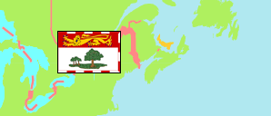
Province
The population development of Prince Edward Island according to official estimates.
| Name | Abbr. | Status | Capital | Area A-L (km²) | Population Estimate (E) 2002-07-01 | Population Estimate (E) 2007-07-01 | Population Estimate (E) 2012-07-01 | Population Estimate (E) 2017-07-01 | Population Estimate (Ep) 2022-07-01 | |||
|---|---|---|---|---|---|---|---|---|---|---|---|---|
| Canada | CAN | Fed | Ottawa | 8,965,121 | 31,358,418 | 32,887,928 | 34,752,128 | 36,545,236 | 38,929,902 | → | ||
| Prince Edward Island | PEI | Prov | Charlottetown | 5,686 | 136,876 | 137,721 | 145,258 | 150,402 | 170,688 | 568600 | → |
- Statistics Canada (web).
Contents: Cities & Towns
The population of all cities and towns on Prince Edward Island according to official estimates.
| Name | Status | Population Estimate (E) 2002-07-01 | Population Estimate (E) 2007-07-01 | Population Estimate (E) 2012-07-01 | Population Estimate (E) 2017-07-01 | Population Estimate (Ep) 2022-07-01 | Area | ||
|---|---|---|---|---|---|---|---|---|---|
| Alberton | Town | 1,103 | 1,027 | 1,116 | 1,137 | 1,417 | 452 | → | |
| Borden - Carleton | Town | 805 | 797 | 763 | 745 | 805 | 1299 | → | |
| Charlottetown | City | 32,650 | 32,876 | 35,968 | 38,527 | 44,310 | 4434 | → | |
| Cornwall | Town | 4,504 | 4,820 | 5,429 | 5,716 | 6,649 | 2819 | → | |
| Georgetown | Town | 718 | 644 | 647 | 604 | 761 | 159 | → | |
| Kensington | Town | 1,422 | 1,529 | 1,571 | 1,719 | 2,071 | 301 | → | |
| Montague | Town | 1,984 | 1,789 | 2,036 | 2,022 | 2,439 | 316 | → | |
| North Rustico | Town | 629 | 589 | 605 | 643 | 749 | 241 | → | |
| O'Leary | Town | 875 | 893 | 782 | 837 | 903 | 168 | → | |
| Souris | Town | 1,244 | 1,274 | 1,152 | 1,026 | 1,146 | 347 | → | |
| Stratford | Town | 6,543 | 7,321 | 8,993 | 10,368 | 12,414 | 2253 | → | |
| Summerside | City | 14,867 | 14,648 | 15,206 | 15,190 | 15,993 | 2849 | → |
- Since September 2018, Georgetown, Montague and surrounding areas form Three Rivers town with a population of 7,880 (2021 census).
- Statistics Canada (web).