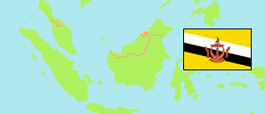
Mentiri
Mukim in Brunei Muara District
Contents: Subdivision
The population development in Mentiri as well as related information and services (Wikipedia, Google, images).
| Name | Status | Population Census 2011-06-20 | Population Census 2016-05-01 | Population Census 2021-04-20 | |
|---|---|---|---|---|---|
| Mentiri | Mukim | 15,203 | 30,192 | 39,324 | |
| Kampung Batu Marang | Quarter | 1,026 | 870 | 748 | → |
| Kampung Mentiri | Quarter | 1,488 | 1,215 | 1,858 | → |
| Kampung Panchor | Village | 0 | 0 | 0 | → |
| Kampung Pangkalan Sibabau | Quarter | 592 | 699 | 876 | → |
| Kampung Salar | Quarter | 528 | 846 | 987 | → |
| Kampung Sungai Buloh | Quarter | 3,400 | 3,857 | 4,351 | → |
| Kampung Tanah Jambu (incl. Perumahan Negara Tanah Jambu) | Quarter | 2,348 | 8,809 | 11,695 | → |
| Perumahan Negara Mentiri Kawasan A | Quarter | 2,685 | 2,880 | 2,597 | → |
| Perumahan Negara Mentiri Kawasan B | Quarter | 3,136 | 3,081 | 2,854 | → |
| Perumahan Negara Panchor | Quarter | 0 | 7,935 | 13,358 | → |
| Pulau Bedukang | Island | 0 | 0 | 0 | → |
| Pulau Kaingaran | Island | 0 | 0 | 0 | → |
| Pulau Pasir Tengah | Island | 0 | 0 | 0 | → |
| Pulau Simangga Besar | Island | 0 | 0 | 0 | → |
| Brunei Muara | District | 279,924 | 289,630 | 318,530 |
Source: Department of Economic Planning and Development, Brunei (web).
Explanation: Area figures are computed by using geospatial data. Urban/rural categorization according to 2016 census.
Further information about the population structure:
| Gender (C 2021) | |
|---|---|
| Males | 20,024 |
| Females | 19,300 |
| Age Groups (C 2021) | |
|---|---|
| 0-14 years | 9,366 |
| 15-64 years | 28,452 |
| 65+ years | 1,506 |
| Citizenship (C 2021) | |
|---|---|
| Brunei | 35,631 |
| Permanent Resident Foreigners | 1,173 |
| Temporary Resident Foreigners | 2,520 |
| Urbanization (C 2021) | |
|---|---|
| Urban | 39,324 |