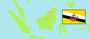
Kota Batu
Mukim in Brunei Muara District
Contents: Subdivision
The population development in Kota Batu as well as related information and services (Wikipedia, Google, images).
| Name | Status | Population Census 2011-06-20 | Population Census 2016-05-01 | Population Census 2021-04-20 | |
|---|---|---|---|---|---|
| Kota Batu | Mukim | 15,071 | 12,935 | 12,676 | |
| Kampung Belimbing | Quarter | 3,246 | 2,721 | 2,789 | → |
| Kampung Buang Tawar | Village | 12 | 10 | 7 | → |
| Kampung Dato Gandi | Quarter | 437 | 424 | 332 | → |
| Kampung Gadong Batu | Village | 0 | 0 | 0 | → |
| Kampung Kota Batu | Quarter | 807 | 588 | 528 | → |
| Kampung Menunggul | Village | 519 | 541 | 369 | → |
| Kampung Pelambaian | Quarter | 792 | 714 | 630 | → |
| Kampung Pintu Malim | Quarter | 653 | 319 | 289 | → |
| Kampung Pudak | Village | 210 | 151 | 127 | → |
| Kampung Pulau Baru-Baru | Village | 15 | 18 | 11 | → |
| Kampung Riong | Village | 46 | 41 | 17 | → |
| Kampung Serdang | Quarter | 675 | 609 | 497 | → |
| Kampung Subok | Quarter | 3,213 | 2,681 | 3,258 | → |
| Kampung Sungai Belukut | Quarter | 656 | 612 | 652 | → |
| Kampung Sungai Besar | Quarter | 2,331 | 2,039 | 1,816 | → |
| Kampung Sungai Lampai | Quarter | 240 | 314 | 350 | → |
| Kampung Sungai Matan | Quarter | 404 | 356 | 281 | → |
| Kampung Tanjong Kindana | Village | 811 | 797 | 723 | → |
| Mengkubau | Area | 0 | 0 | 0 | → |
| Pulau Berbunut | Island | 0 | 0 | 0 | → |
| Pulau Chermin | Island | 0 | 0 | 0 | → |
| Pulau Pepatan | Island | 0 | 0 | 0 | → |
| Pulau Sibungur | Island | 4 | 0 | 0 | → |
| Pulau Silamak | Island | 0 | 0 | 0 | → |
| Pulau Silipan | Island | 0 | 0 | 0 | → |
| Brunei Muara | District | 279,924 | 289,630 | 318,530 |
Source: Department of Economic Planning and Development, Brunei (web).
Explanation: Area figures are computed by using geospatial data. Urban/rural categorization according to 2016 census.
Further information about the population structure:
| Gender (C 2021) | |
|---|---|
| Males | 6,610 |
| Females | 6,066 |
| Age Groups (C 2021) | |
|---|---|
| 0-14 years | 2,424 |
| 15-64 years | 9,183 |
| 65+ years | 1,069 |
| Citizenship (C 2021) | |
|---|---|
| Brunei | 8,807 |
| Permanent Resident Foreigners | 1,335 |
| Temporary Resident Foreigners | 2,534 |
| Urbanization (C 2021) | |
|---|---|
| Rural | 1,254 |
| Urban | 11,422 |