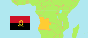
Cela
Municipality in Angola
Contents: Population
The population development of Cela as well as related information and services (Wikipedia, Google, images).
| Name | Status | Population Census 2014-05-16 | Population Projection 2022-07-01 | |
|---|---|---|---|---|
| Cela (Waku Kungo) | Municipality | 225,520 | 284,115 | |
| Angola | Republic | 25,789,024 | 33,086,278 |
Source: Instituto Nacional de Estatística, República de Angola (web).
Explanation: Area figures of municipalities are derived from imprecise geometries.
Further information about the population structure:
| Gender (P 2022) | |
|---|---|
| Males | 137,008 |
| Females | 147,106 |
| Age Groups (C 2014) | |
|---|---|
| 0-14 years | 113,987 |
| 15-64 years | 106,101 |
| 65+ years | 5,432 |
| Age Distribution (C 2014) | |
|---|---|
| 0-9 years | 87,781 |
| 10-19 years | 49,813 |
| 20-29 years | 32,649 |
| 30-39 years | 20,208 |
| 40-49 years | 16,017 |
| 50-59 years | 10,230 |
| 60-69 years | 5,345 |
| 70-79 years | 2,430 |
| 80+ years | 1,047 |
| Urbanization (C 2014) | |
|---|---|
| Rural | 127,533 |
| Urban | 97,987 |
| Literacy (A15+) (C 2014) | |
|---|---|
| yes | 65,288 |
| no | 46,246 |
| Spoken Language(s) (C 2014) | |
|---|---|
| Portuguese | 164,909 |
| Umbundu | 44,675 |
| Kimbundu | 77,283 |
| Kikongo | 1,525 |
| Chokwe | 532 |
| Nganguela | 413 |
| Nhaneca | 152 |
| Fiote/Ibinda | 1,742 |
| Cuanhama | 357 |
| Luvale | 143 |
| Muhumbi | 521 |
| Deaf-mute | 225 |
| Other language | 2,047 |
| Religion (C 2014) | |
|---|---|
| Catholics | 43,075 |
| Protestants | 74,048 |
| Indigenous religion | 321 |
| Muslims | 299 |
| Jews | 275 |
| Other religion | 5,158 |
| No religion | 102,345 |
