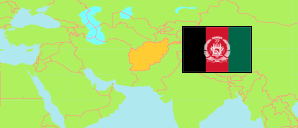
Balkh
Province in Afghanistan
Contents: Subdivision
The population in Balkh as well as related information and services (Wikipedia, Google, images).
| Name | Status | Native | Population Projection 2020-09-21 | |
|---|---|---|---|---|
| Balkh | Province | بلخ | 1,509,183 | |
| Balkh | District | بلخ | 136,097 | → |
| Chār Bōlak | District | چار بولک | 91,539 | → |
| Chārkent [Charkint] | District | چارکنت | 50,220 | → |
| Chimtāl | District | چمتال | 103,630 | → |
| Dehdādī [Dihdadi] | District | دهدادی | 76,261 | → |
| Dowlat Ābād [Dawlatabad] | District | دولتآباد | 119,083 | → |
| Kaldār [incl. Shahrak-e Ḥayratān] | District | کلدار | 22,586 | → |
| Khulm [Kholm] | District | خلم | 83,032 | → |
| Kishindeh [Kishindih] | District | کشنده | 55,003 | → |
| Mārmul | District | مارمل | 12,888 | → |
| Mazār-e Sharīf [Mazar-i-Sharif] | Capital District | مزار شریف | 484,492 | → |
| Nahr-e Shāhī [Nahri Shahi] | District | نهر شاهی | 50,752 | → |
| Shōlgarah [Sholgara] | District | شولگره | 129,271 | → |
| Shōrtepah [Shortepa] | District | شورتپه | 44,773 | → |
| Zārī | District | زاری | 49,556 | → |
| Afghānestān [Afghanistan] | Islamic Republic | افغانستان | 32,890,200 |
Source: Central Statistics Office Afghanistan (web).
Explanation: The projection is based on the household listing performed from 2003 to 2005; the reliability of the figures is low. Nomades are only included in the total population of Afghanistan. Area figures of districts are computed by using geospatial data.
